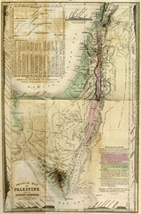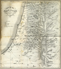
"Map of the Holy Land, compiled from the best sources" 1859
Originally uploaded by Special Collections at Wofford College
The fold-out map and an illustration from W.M. Thomson’s two-volume The Land and the Book, a work of “Biblical illustrations drawn from the manners and customs, the scenes and scenery, of the Holy Land.” Published in New York in 1859. From the collection of William Wallace Duncan, a bishop in the Methodist Episcopal Church and Wofford graduate, class of 1858.
Full description