
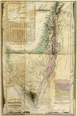
"Physical Map of Palestine and the adjacent countries"
Originally uploaded by Special Collections at Wofford College
A finely-detailed, hand-colored, fold-out map from John Kitto’s The Land of Promise, “a topographical description of the principal places in Palestine, and of the country eastward of Jordan, embracing the researches of the most recent travellers.” Published in London, c. 1852.
Full description


